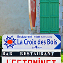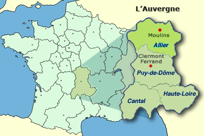
La Croix des Bois is situated about 350 km (270 ml) south of Paris, in the most northern part of the Auvergne, the Allier, in the rural commune of Lalizolle. The municipality is between the towns Montlucon and Vichy, 70 km (43 ml) north of Clermont-Ferrand.
• download directions (in PDF-format)
• Google Maps
• routenet
"Route de Soleil", in use since 2000 traverses the heartland of the Auvergne, making La Croix des Bois easily accessible. The A71 nowadays is extended (via the marvellous landmark bridge at Millau) to Montpellier, providing the traveler easy access to the Mediterranean Sea.
The Auvergne also has airports ar Moulins and Vichy, and furthermore there is the rapid train, the TGV, stopping at Montlucon, Moulins and Vichy. If you would like to get transport from the airport or the train station, please note your arrival time in your hotel reservation.